The hike to the Maryland Heights overlook is arguably the most famous view in West Virginia (even though the cliffs are technically in Maryland!), and is known to be the most challenging. But if you show up expecting to park at the trailhead, this may prove to be more challenging than the hike!
Between permanent parking closures and the 2026 staircase project, getting to the trailhead may be the hardest part of the hike. Here is your local survival guide to making it to the top without a headache.
1. The Parking “Trap”
Do not drive your car to the Maryland side of the river. The trailhead parking lots on Sandy Hook Road are permanently closed. If you park along the narrow shoulder of the road, you are almost guaranteed a ticket or a tow. To reach the trail, you have three legitimate options:
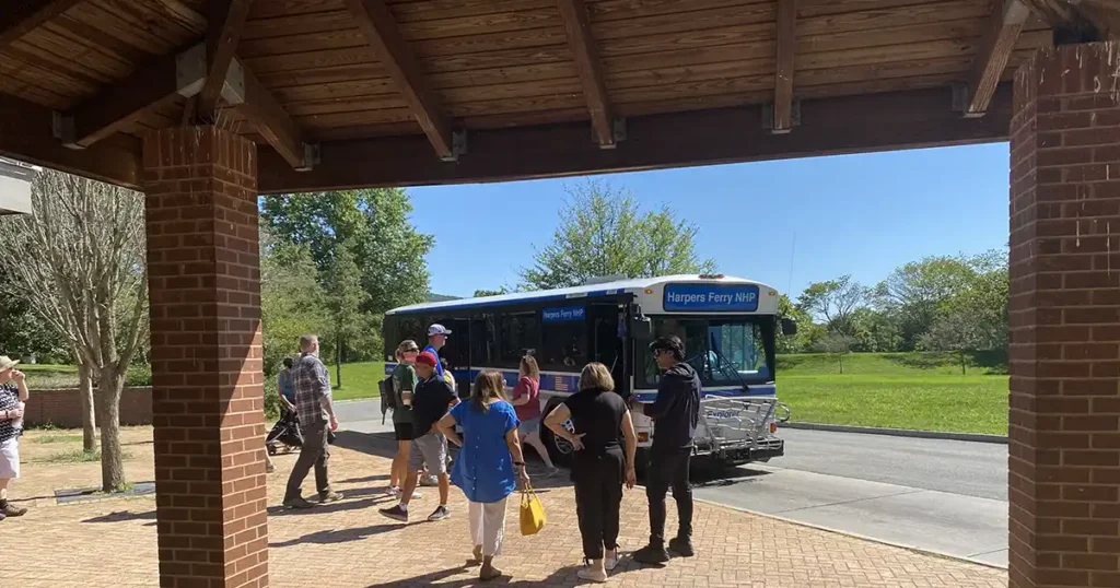
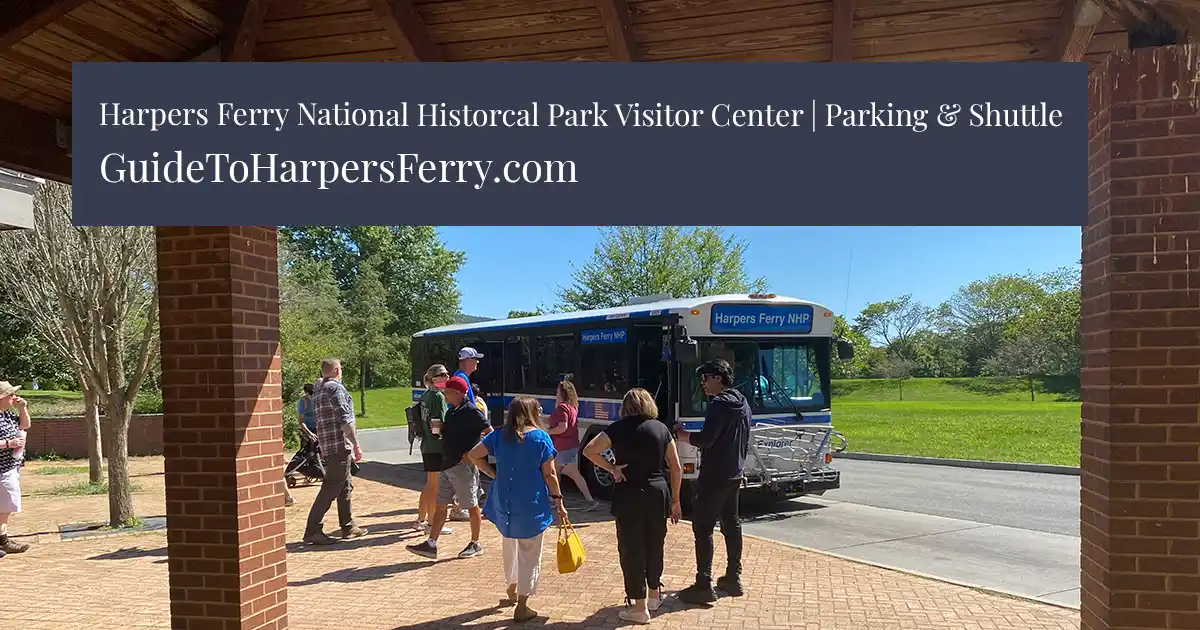
- The Visitor Center (Best Bet): Park at 171 Shoreline Drive ($20 entrance fee) and take the park shuttle down to Lower Town.
- The Train Station: There is limited NPS parking here, but it fills up by 9:00 AM on weekends.
- C&O Canal (Dargan Bend): If you’re looking for a longer day, you can park 3 miles upstream at Dargan Bend and bike or hike down the towpath to the trailhead.
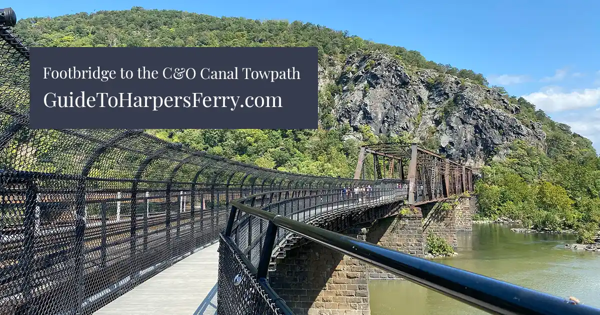
2. The 2026 Footbridge Situation
To get from town to the trail, you have to cross the Goodloe Byron Memorial Footbridge. * Current Status (February 2026): The bridge and the temporary staircase are currently OPEN. You’ll notice scaffolding and a temporary wooden set of stairs while the park service finishes the new permanent staircase.
- Heads Up: The footbridge is scheduled to close briefly in late February/early March to remove the temporary stairs and finalize the project. If you arrive and the bridge is blocked, don’t panic! The park will run a special shuttle from the Visitor Center to Lock 34 on the Maryland side to bypass the closure.
3. The 2026 Seasonal “Rules”
Because Harpers Ferry is a protected habitat, February brings two very important rules:
- Peregrine Falcon Closures (Starts Feb 15): To protect nesting falcons, the cliff-side climbing routes and some rock outcroppings near the overlook are closed from February 15 to July 31. The main hiking trail and the overlook remain open, but stay behind the fences to give the birds their space!
- The “Sunset” Rule: From now through April 13, 2026, the park is conducting deer management. All trails close at sunset. Make sure you start your hike early enough to be back down before dark.
4. Which Trail Should You Pick?
- The Overlook (Red/Green Blazes): 4.5 miles round trip. This takes you to the famous spot looking down on the town and the bridge. It’s steep, so wear real shoes!
- The Stone Fort (Blue Blazes): Adds 2 miles to your loop. It’s a great workout and takes you past Civil War ruins, but it doesn’t have the “town view” of the overlook.
See our places to stay guide for the best lodging options in town.
Also, planning a group trip to hike the heights? Stay tuned for our upcoming guide to the best Harpers Ferry cabins for large groups!